








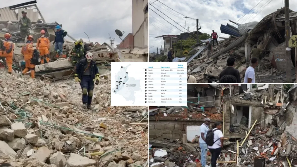
At 7:34 a.m. on Monday, August 10, the largest magnitude earthquake recorded in Colombia in the 21st century occurred, according to the Colombian Geological Service (SGC). It was a 7.4 and had its epicenter in San José del Palmar, in Chocó, at a depth of 103 kilometers.
The earthquake was of intermediate depth and originated within the Nazca plate, which is subducting beneath the Pacific. That depth explains why it was felt in 28 of 32 departments, according to the SGC, and why five of them were severely affected (Chocó, Valle, Caldas, Quindío, and Risaralda).
As of September 15, the National Unit for Disaster Risk Management (UNGRD) reported at least 335 deaths, 4,516 injured and 105 missing, and in total, 486,917 people and 303,934 families affected in 16 departments and 500 municipalities. The earthquake destroyed 36,478 homes and damaged another 206,931.
This seismic event and its severe effects reopened the debate about how earthquake-resistant Colombia really is.
Although the country, on paper, has regulations to prevent building collapses and structural damage, the current regulation is still from 2010 and has not had a comprehensive update, beyond partial modifications such as Decree 1401 of 2023, which incorporated a rule to reduce vulnerability of informal masonry housing. This despite the fact that seismic information from the last 16 years already exists.
A century of earthquakes in the country
Colombia’s seismic history shows that magnitude does not determine devastation. On January 31, 1906, off Tumaco, Nariño, an 8.8 magnitude earthquake caused a tsunami and left more than 1,500 dead, according to historical estimates, scattered due to the low population density of the coast. The contrast comes with two earthquakes from the same northwest region. In 1992, a 7.2 magnitude quake near Murindó caused 10 deaths because it struck a sparsely populated area. Seven years later, a smaller magnitude quake devastated a city: the Armenia earthquake on January 25, 1999, was magnitude 6.1 and according to SGC records left 1,185 dead, 8,536 injured, and 35,972 homes destroyed or uninhabitable, because it hit a dense and vulnerable urban area.
The Data Unit calculated the number of deaths per 100,000 inhabitants in the year of each event, using death figures from the SGC and UNGRD and population series from the National Administrative Department of Statistics (Dane). In Armenia (1999) the rate was 2.94; in Popayán (1983), 0.89; and the August 10, 2026 event, despite its 7.4 magnitude, records a rate of 0.63.
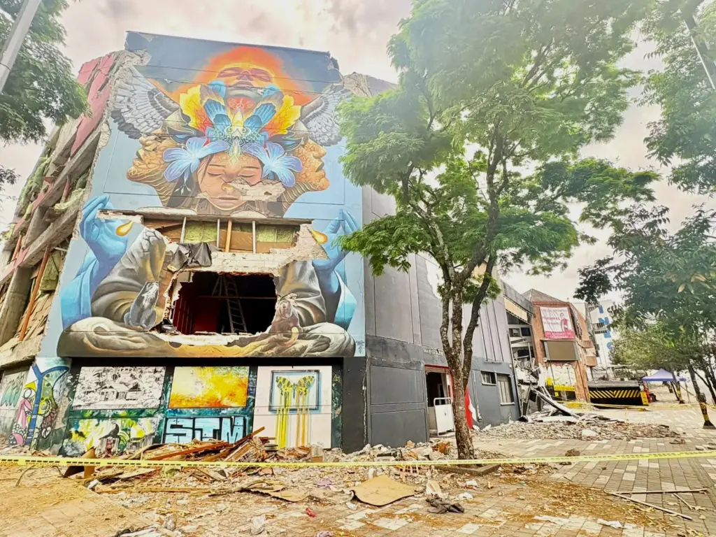
Although the magnitude of an earthquake corresponds to the amount of energy being released, the truth is that depth, the time it occurs, and the quality of the construction are decisive variables in the scale of a tragedy.
What about regulations in Colombia?
The first earthquake-resistant code emerged after the Popayán earthquake of 1983. One year after the seismic event, Decree 1400 of 1984 was issued to seek protection of buildings so fewer people would die from structural collapses.
Fourteen years later, in 1998, the regulation was updated to NSR-98, which included new technical parameters and seismic threat assessments. In 2010, through Decree 926, it was updated again.
That, the NSR-10, the current national code, is considered one of the most demanding in the region.
According to the document, it should be updated periodically to reflect advances in design techniques and experiences with recent earthquakes.
Beyond buildings remaining intact, the code aims to prevent deaths through the presentation of “minimum requirements that, to some extent, guarantee the primary purpose is met of safeguarding human lives during a strong earthquake”. Thus, property protection is secondary.
In that sense, buildings are designed to withstand a strong and rare earthquake, the size of which on average occurs once every 475 years. Essential buildings, such as hospitals, and those with large occupancy, like schools, are held to even higher standards by the code.
Juan Carlos Reyes, structural engineer from the University of Los Andes, explains that the regulation is not recent. “Colombia has had this type of regulations since 1984. All urban projects built after that date should have been designed and constructed to comply with these guidelines”, he mentions. The problem is that “older buildings or informal constructions may not have been designed or built following any earthquake-resistant guidelines”, clarifies the expert.
Buildings constructed under the regulation should withstand, as Reyes points out, low-intensity tremors without damage, moderate tremors without structural damage “but possibly with some damage to non-structural elements, and a strong tremor with damage to structural and non-structural elements, but without collapse”.
Also, it is not enough to declare the country earthquake-resistant. Two important distinctions must be made. Daniel Ruiz, professor of Engineering at Javeriana University, states that “Colombia has a good tradition of engineering and regulation, but that does not mean the entire built country complies”. The impact of an earthquake does not depend solely on its magnitude, but also on the “intensity of the movement in each location, the soils, the exposure, and, especially, the vulnerability of the buildings”, he warns. Although the country has made great progress, there is still a very heterogeneous building stock and a significant debt “with old, informal, and vulnerable buildings”.
Real earthquake resistance depends on three factors that the code alone does not guarantee. They are compliance, the condition of the existing or informal building stock, and the reinforcement of what exists.
Although there is no official consolidated figure on how much of the building stock was constructed without the current code, the Data Unit estimated it based on the GEM exposure model, a database that includes 9.84 million buildings in the country. According to that model, about 3 out of 4 buildings would not have earthquake-resistant design (74.9 percent).
The National Professional Council of Architecture estimated in 2023 that at least 52 percent of buildings predate the NSR-10 and that, of every five new homes entering the market, three are informal.
Meanwhile, Dane, in the 2018 census, reports that 36.6 percent live in housing deficit, meaning in homes with structural or remediable deficiencies.
Where tremors affect the country most
The District Institute of Risk Management and Climate Change (Idiger) and the document Seismic Risk in Colombia, by UNGRD and the Seismic Engineering Association, established that 83 percent live in zones of high seismic threat.
The country lies at the confluence of the Nazca, South American, and Caribbean plates. Among its main seismic sources are the Pacific subduction, the Romeral fault system, and the Bucaramanga Seismic Nest.
To understand which areas are more exposed, two often-confused issues must be separated. One is threat, which measures how strong shaking can be in a place due to geological reasons, such as faults or soil type, and is what seismic maps show. The other is risk, which combines that threat with how much is built in the area and how fragile the construction is. A threat map shows where strong shaking can occur and risk shows how much can be lost when it happens.
The difference is seen in Bogotá. On the national map, the city appears as intermediate threat, but its soil type demands more robust construction, experts say. That is why District Decree 523 of 2010 adopted a microzonation that requires building with higher standards than the national code.
The UNGRD Risk Atlas and the GEM global model agree that, to compare threat, exposure, and vulnerability, the expected annual loss is useful, which estimates how much money in assets would be lost on average per year due to earthquakes.
That figure can be read in two ways. The first is absolute loss, which is the total money lost each year. Valle del Cauca, Bogotá, and Santander lead. According to GEM, Valle loses an average of 109.8 million dollars per year and Bogotá, 98.9 million.
The second is relative loss, which is the fraction of exposed assets lost. Here the list changes and Chocó leads. In dollars, the estimate is that this department loses 8.3 million per year, but proportionally it loses more than triple the national average: for every 1,000 dollars built, 1.6 is lost annually, compared to 0.5 in the country.
The distinction matters because it points to two different problems. Bogotá loses a lot of money in total, even if it is a smaller part of its immense exposed wealth. Chocó loses little money, but it is almost all it has. Experts indicate that relative loss says more than absolute loss to know where an earthquake would be more devastating.
In that vein, reviewing the calculations, high relative risk is concentrated in the Pacific west —Chocó, Valle del Cauca, Cauca, and Nariño— where much of the severe damage from the August 10 earthquake was concentrated, and in a strip of Santander near the Bucaramanga Seismic Nest.
Both models agree on that ranking, with Chocó first in relative loss, although they differ in amounts. The UNGRD Atlas measures several threats at once and estimates higher losses, while GEM measures only the earthquake. Still, they point to the same department with different figures. Neither measures what comes after the emergency, such as soil liquefaction, landslides, tsunami, or road damage.
The Atlas adds a social component to that measurement. It builds an index of socioeconomic fragility for each municipality, based on the idea that the same tremor hits harder where poverty, informality, and institutional weakness converge. Chocó has all those factors. It is one of the poorest departments in the country, with a multidimensional poverty of 30.8 percent in 2025 according to Dane, was the epicenter of the earthquake, and has a building stock mostly without codes, with few resources to reinforce or rebuild. In other words, inequality ends up multiplying the risk.
DATA UNIT
sabbas@eltiempo.com / berdav@eltiempo.com
More news
Earthquake: claims to insurers reach 84,534 and cost of damages rises to $4.4 trillion
How to claim a 1 million peso subsidy for families affected by the earthquake: check if you are a beneficiary and prioritized cities
154 trees, 154 stories: the emotional tribute to the victims of the earthquake that shook Cali on August 10
Read more For another feat like Monumental: Vasco da Gama vs Santa Fe, minute by minute


